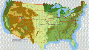
Updated Giant United States Hex Map w/Railroads, Circa 1870

The last Hexographer update from a month or so ago included a new line style: Railroads. To try out the new feature, I thought I’d put together a large hex map of the United States based on a map from 1870.
Actually, there were many more railroads on the source map, but this map has all the larger/seemingly more important railroads. Also note that Hexographer has a feature type that allows you to place railroads as symbols, but these railroads are drawn using the Railroad line style/type.
The railroads drawn as symbols look a bit nice than these, but they also are more tedious to place. The new line style shown here also has the advantage that it is easier to place them more exactly.
This map also marks the locations of many Indian tribes at the time the source map was created.
(Note: This map was posted a couple of months ago, but it only had a small number of railroads and the locations of several cities were updated.)
Click the map for the full size version. Note that it will likely be re-sized by your web browser to fit the browser window, but clicking on it again will give you the full size and then you may pan it. Or save it for viewing in your favorite image editor/viewer.

0 Comments on “Updated Giant United States Hex Map w/Railroads, Circa 1870”